 Chinese Culture
The Land Of China -- Landmarks
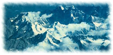
the Himalayas
In General
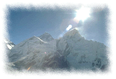
The Sanskrit name Himalaya, meaning "abode of snow," truly characterizes the vast permanent snowfields above the snow line. Watching the Himalayas - cool, lofty and majestic - can be a breathtaking experience.
|
The highest mountain range on Earth, the Himalayas, comprise three almost parallel ranges interspersed with large plateaus and valleys, forming the northern border of the Indian subcontinent in Asia. The Himalayas extend between the latitudes 26 20 and 35 40 North and between the longitudes 74 50 and 95 40 East, covering an area of 612,021 square kilometers. Several northern Indian states and the kingdoms of Nepal and Bhutan lie along the southern slopes of the Himalayas, and the Tibetan Highlands of China border them in the north.
|
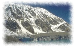
The most characteristic features of the Himalayas are their great height, complex geologic structure, snowcapped peaks, large valley glaciers, deep river gorges, and rich vegetation. From south to north the Himalayan ranges can be grouped into four parallel belts of varying width. They are the Outer Himalayas; the Lesser, or Lower, Himalayas; the Great, or Higher, Himalayas; and the Tethys, or Tibetan, Himalayas. The Karakoram Range in the northwest is also sometimes considered part of the Himalayan system.

|
The Himalayas act as a great divider and influence the climatic conditions of the Indian subcontinent to the south and of the Central Asian highland to the north. The mountain ranges obstruct the cold, dry air from the north in winter. They also force the monsoonal winds to give up moisture, causing heavy rain and snow on the southern side but arid conditions in northern Tibet. Rainfall decreases from east to west.
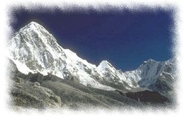
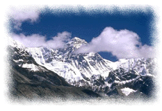
Everest, Glamorous yet Tragic
Mount Everest is located in Southwestern China and stands 29028 feet above sea level. Everest was first attempted in 1921 by a group led by George Mallory but it was not until 1953 when New Zealander Sir Edmand Hillary and Sherpa Tenzing Norgay made the summit via the south col route.
|
Five miles up, the world's highest summit is at about the cruising altitude of a jet. At that height, only a third of the oxygen at sea level is available. The summit of Everest is a living room-sized mound of snow marked by various flags and science gear. Depending on the level of recent wind and snowfall, there can be varying degrees of exposed rock. In clear weather, the view goes on for hundreds of miles: a network of glaciers running off the mountain below; Himalayan peaks all around (Lhotse, Nuptse, Makalu, Cho-Oyu, Pumori);
|
The Death Zone on Everest is above 26,000 feet. Even acclimated, the body begins to shut down, and if a person stays that high long enough, they will die. Most climbers use oxygen here for climbing and sleeping.


